
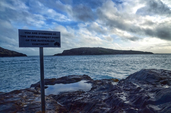
It is truly difficult to comprehend the size of my country. Standing next to a sign informing me I’ve reached the northernmost point of the Australian continent, my mind boggles at what lies south.
The craggy nature of the rocks along the coast also makes it hard to appreciate that I am, in fact, at the top. York and Eborac islands are within swimming distance, if one was stupid enough to brave the ridiculous currents between the mainland and two of the Torres Strait islands that remind me I’m not standing on the edge of my country – just the continent.
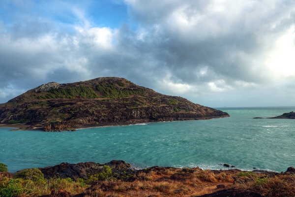
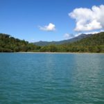
For most visitors to Cape York reaching this point is the goal. Pajinka, the Aboriginal name for the land at The Tip, and its turquoise waters and long sandy beach is the reward after braving those red, bumpy, dusty roads for almost 1000km.
The Tip would arguably be one of the most visited sites in Cape York, but you wouldn’t know that from the single-lane, dirt and sand track we followed through the bush to get there. It’s definitely 4WD-only territory, as are a lot of the roads up here.
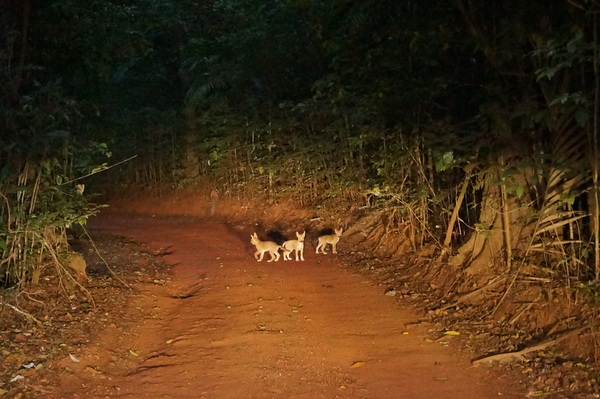
I’m constantly surprised at the diversity of the landscape in this part of Far North Queensland. After driving through the Aboriginal community of Bamaga and turning off for Pajinka, we spent most of the trip shadowed by rainforest, with branches and leaves dangling from the canopy, with intermittent patches of dry forest with eucalyptus and banksias. The wildlife was scarcer than I expected – although we got a nice surprise when we turned a corner and startled three dingo pups with our headlights.
Just before the car park for The Tip are the abandoned buildings of the former Pajinka Wilderness Lodge. The infrastructure is a shock after driving along a road that feels like it isn’t leading anywhere. I didn’t take any interest in it at the time and it wasn’t until I began researching the site in the following days that I learnt the history of the buildings (which I didn’t even bother to photograph).
As far as I can deem from research, the Cape York Wilderness Lodge was opened in 1986 by Bush Pilot Airways (later Air Queensland) which reportedly owned 3600 acres of land including The Tip itself. The resort cost $1.2 million and was known for its fishing charters and a popular Indigenous experience it offered to guests. Ownership changed to another airline, the now defunct Ansett Australia, and later to Qantas Airlines, who owned it at the time it was sold to the Injinoo Aboriginal Cooperation in 1992. The resort, by then renamed the Pajinka Wilderness Lodge, closed in 2002 for renovations and was due to reopen in 2003, but it never did. “Poor management” was one of the key reasons given as to why the lodge closed and there are reports of clashes between Indigenous staff from different clans and a staff walk-out over unpaid wages.
I found suggestions that the lodge should be redeveloped, but we would have had a very different experience if there was a resort on the doorstep on this site.
We drove to the end of the road (literally!!) and parked under a coconut tree steps from Frangipani Beach. Just after 7am we were the third car in the car park. By the time we left, nearly four hours later, cars were coming and going in convoy.
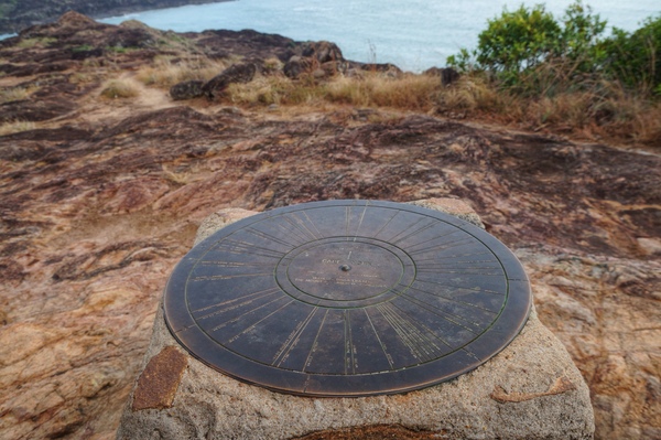
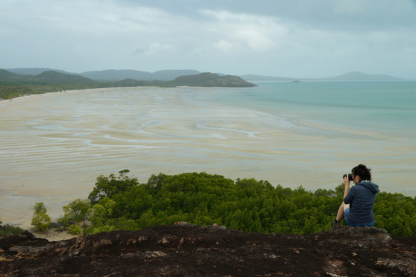
The rough roads made us late for sunrise, but the clouds blocked it anyway. Instead we had a rainbow greeting us as we walked around the mangroves at the north end of Frangipani Beach. There is a track behind the car park which climbs past several cairns leading the way to The Tip, but at low tide you can walk around the beach and clamber up the rocks from the side.
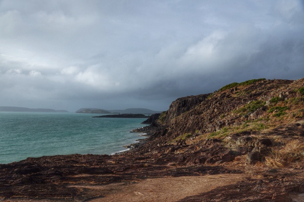
The water is rough here, with currents clashing from all directions. With the dark clouds, the sun fighting to break through and a rainbow to the west, it was a very dramatic sight. In my head I pictured a map of Australia and imagined what a teeny tiny dot I’d be as I stood on that tip in Far North Queensland. It’s a very humbling experience.
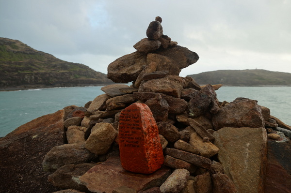
A couple of plaques have been attached to the larger rocks – one acknowledging The Tip as the final resting place for a man who had a lifelong dream to come here. The series of cairns scattered around the rocks give you an idea of the people who make the trek here. One bright orange rock had a message on it saying it had been carried from Cockle Creek, the most southern point of mainland Tasmania, all the way to The Tip. That’s a journey of about 3700km!
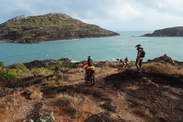
We met one family on the beach, but had The Tip to ourselves until a group of trail riders came over the hill. The riders were from Victoria and had shipped their bikes to Cairns and had ridden from there. I watched as they navigated a course down the rocks all the way to the sign at the bottom. My visit here is part of a much longer trip, in fact I’m just over a week in – so coming to The Tip didn’t feel climactic. But after riding 1000km on those horrible roads, I’m sure those guys were ecstatic to reach their goal. They celebrated with a race along the beach.
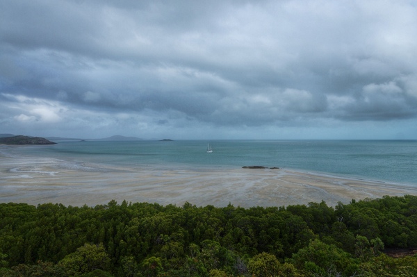
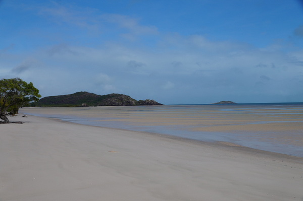
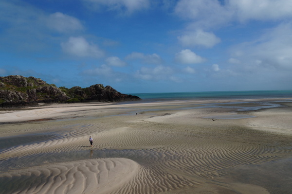
Frangipani Beach stretches for almost 3km from the west of The Tip and we spent almost two hours walking along it. It was raining slightly when we arrived and off and on while we explored The Tip, but it brightened as we walked along the beach.
On the way back I could see the outline of people climbing up to The Tip and wasn’t surprised to see the car park full. The chance to explore this place in peace is definitely worth the early start.
We got back in the car and went the only way we could from here – south.


3 Comments
Looks beautiful, definitely on my list to go. Your rainbow photo is amazing as well.
We reached the Tip a few days after leaving Laura where we had seen the local Aborigines coming from all parts of the Cape for their annual Corroboree! What an experience that was! And the Cape topped it off nicely!
Stayed there when it was Pajinka Wilderness Lodge. It was a fantastic stay. The resort was perfect for the location and it was managed beautifully by locals and others. We met very interesting people and believe it is such a shame. I have seen photos of it now and it has been truly destroyed. I imagine the administration and management program would be a difficult one to have it renovated.
ps It was great to be at the tip having grown up in Tasmania too!