“No way I’d take a caravan through here.”
The voice over the radio most likely came from one of the vehicles we’d let pass us.
A few minutes earlier a guy in a ute heading the opposite direction had pulled over to chat and had a similar opinion.
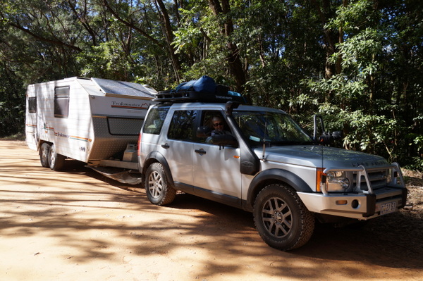
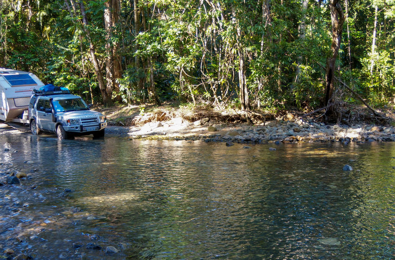
“I hope you’re not planning on taking that all the way through,” he said, referring to the six-metre caravan we were towing along the 4WD-only Bloomfield Track in Far North Queensland.
We informed him that yes, that’s exactly what we were doing.
When my Dad visited Cape Tribulation in 1982 the bulldozers were starting work on the road that now connects the Cape to Cooktown, 100km north. The road was controversial, with environmentalists opposed to further development through the Daintree Rainforest. They protested and although their campaign led to declaration of the Wet Tropics World Heritage Area in 1988, it didn’t stop the track.
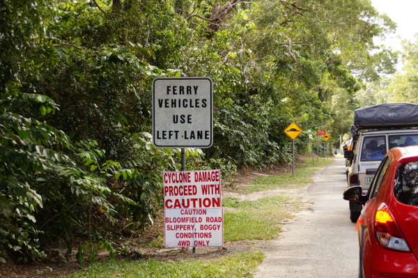
For most vehicles Cape Tribulation is as far as they can go. To travel any further north they have no choice to backtrack to Mount Molloy before taking the Mulligan Highway inland. But four-wheel-drive owners have another option: the 30-km dirt track between Cape Tribulation and Bloomfield.
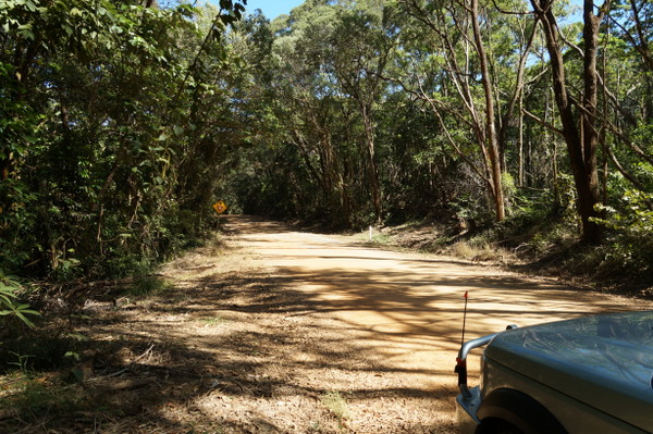
The track is impassable in the wet season and challenging in the dry. It travels through mountainous rainforest, taking drivers up steep climbs before descending into rocky, creek crossings.
My parents bought an off-road caravan so they wouldn’t be limited on where they could travel, but the Bloomfield Track was putting it to the test. A guy at a tourist information centre warned us it would be rough and busy, but that we’d get through. I’m not sure many of the drivers we met on the track shared his optimism.
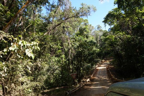
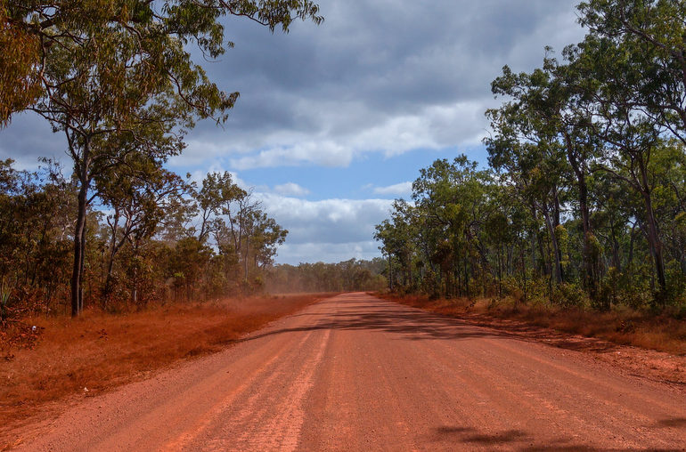
Five kilometers after leaving Cape Tribulation we hit 4WD-only territory. The usually green leaves and trees on the side of the road were white, blanketed with dust from the gravel road. A sign warned us there were no toilets for 30km.
Fifty minutes later we’d travelled six kilometers.
We warmed up on some steady climbs and a couple of creek crossings. In the beginning we could see the Coral Sea glistening through the trees to our right, but after we turned inland the view changed to mountains. The fun began at Donovan Range. We drove past the sign and immediately started going up, with no indication when the hill would end. The vehicles behind us waited at the bottom, probably keeping their distance in case we started going backwards. At the top we waited for them, stopping to take photos of the view between the trees in the meantime.
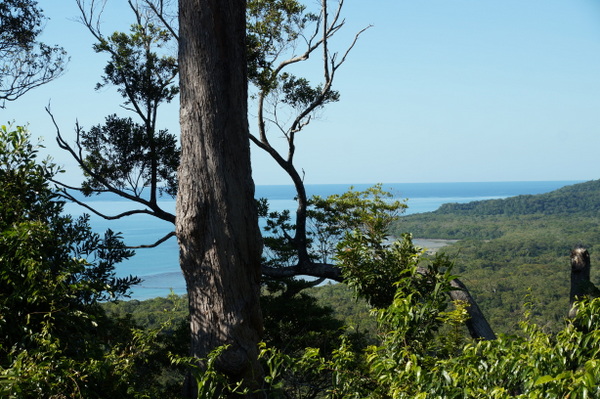
It was here that the warning came.
“It gets a lot more steep and a lot more rough,” the ute driver said. He was going south, having just tackled the terrain that lay ahead of us.
To be fair, he was right. Mum powered up the inclines and slowed to a crawl to navigate the ruts on the descents. She was the only female I saw behind the wheel. Dad navigated from the passenger seat, watching for rocks and ruts. I sat in the back gripping the head rest and keeping my eyes peeled for the top of the hill.
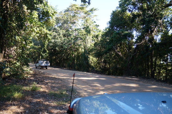
The track is quite sheltered from the surrounding rainforest and the shadows from the trees make it difficult to see the road clearly. For most of the journey you’re either going up or coming down, and we never knew exactly how far up or how far down. Often the only level ground came on the plateau at the top of a hill, where we were occasionally rewarded with views of the mountain ranges around us, or during a creek crossing, when the water steamed where it hit the brakes. The photos don’t show the true nature of the track – mostly because the pictures either came up blurry because of all the bumps or I was too busy holding on to take any.
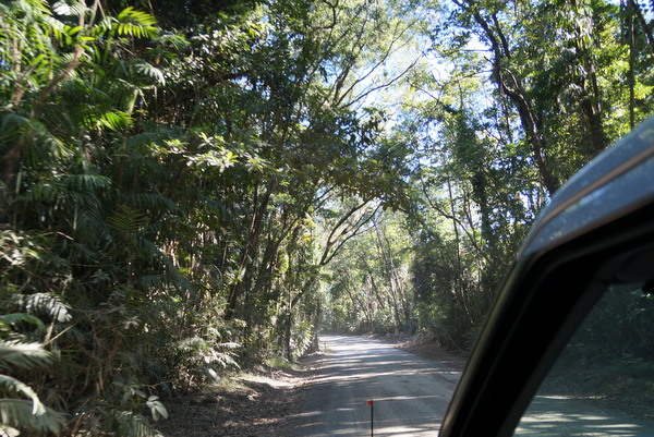
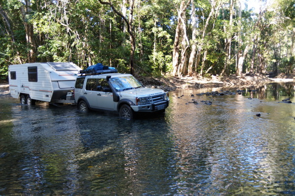
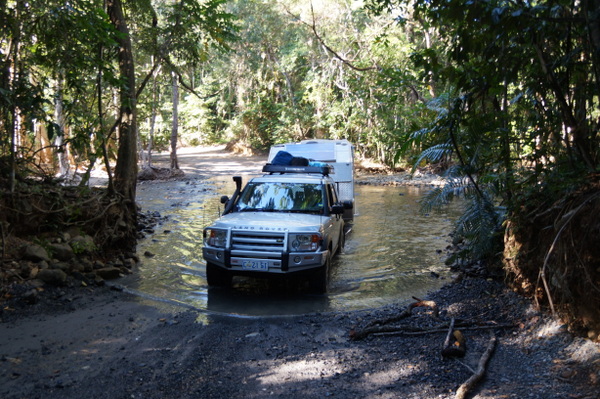
At Cowie Range, the half way point, the roads got steeper. We got slower. The thick rainforest began to thin out and the dirt on the road turned deep red.
There were few signs of life for about 27km, until we saw power lines and some houses as we neared the Aboriginal community of Wujal Wujal, the site of the former Bloomfield River Mission. This was also the end of the continuous gravel road we’d had since Cape Tribulation and technically the end of the Bloomfield Track. It had taken us two hours to travel 30km.
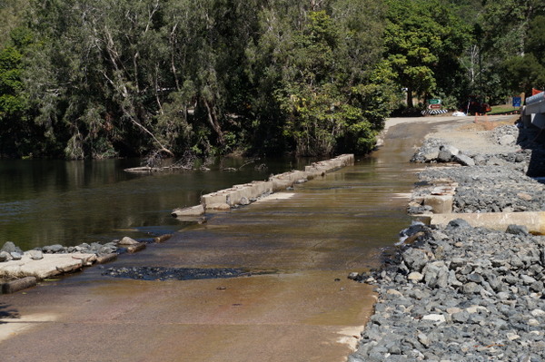
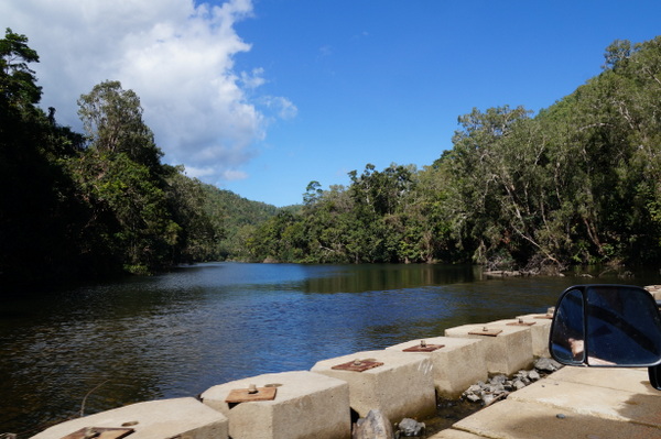
Straight after the river crossing there’s the option to turn left to visit the Bloomfield Falls, however we continued on the road to Cooktown.
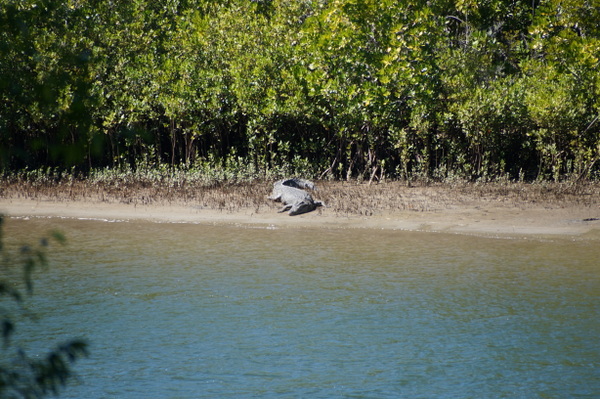
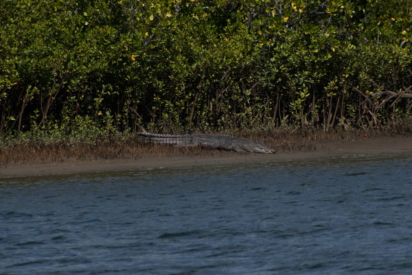
The road follows the Bloomfield River, which is where we spotted one of the local residents – a giant croc on the other side of the water.
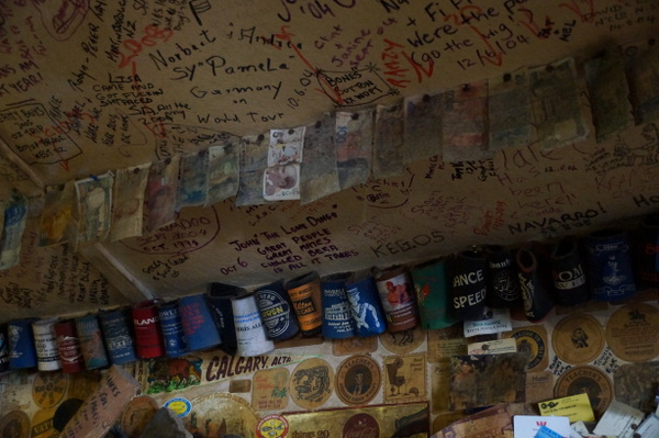
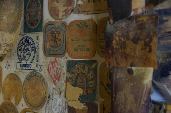
About 40km from Bloomfield is the Lions Den Hotel. The hotel opened in 1875 and stayed in the same family for almost 90 years. It’s an iconic stop near Cooktown, mostly because of the signatures that cover nearly every inch of the interior. The tradition began when workers from the nearby mines gave their wages to the pub and kept a tally of how much they had spent by writing it on the wall. The original writings are gone and the oldest ones there now go back about 30 years.
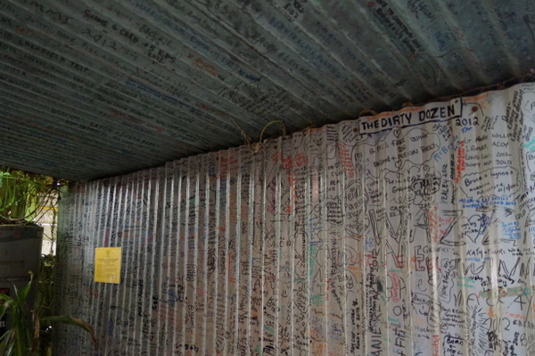
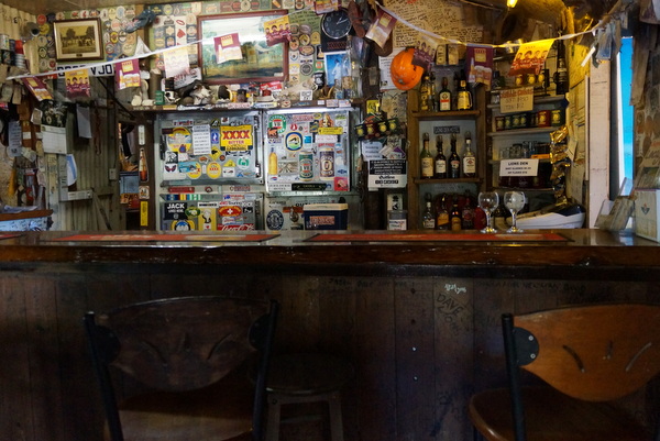
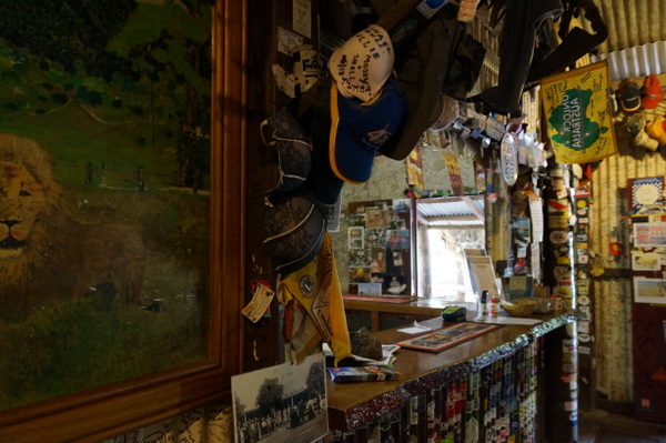
The signatures are just the beginning of what there is to look at in this place.
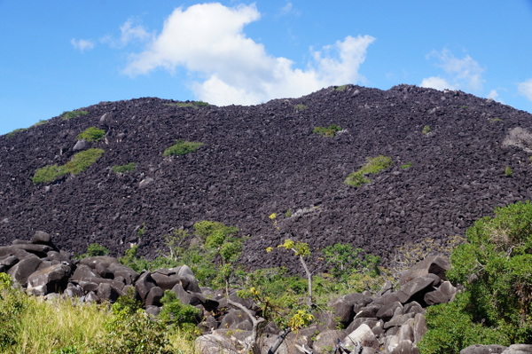
Our last stop before Cooktown was the lookout in Black Mountain National Park, which is part of the Wet Tropics World Heritage Area.
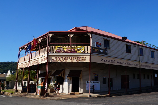
Five hours after leaving Cape Tribulation we arrived in Cooktown, which got its name after Captain James Cook, who brought his ship, Endeavour, here to repair it after hitting the reef at Cape Tribulation. The town has some beautiful buildings and a few memorials to Captain Cook and his ship. Beware though, many of the shops and cafes close at 2pm.
***The Bloomfield Track was particularly challenging with the caravan, but it was mostly a case of taking it easy. I was probably more nervous than my parents because I don’t really know what the Land Drover and the van are capable of. Had there been recent rain, we wouldn’t have attempted the track. We didn’t see another van on the way, but did meet a guy at Bloomfield who was heading out to do a reconnaissance before taking his Trakmaster (the same make of van as we have) through the following day. For information on road conditions visit the Cook Shire website.

3 Comments
Hi , interesting read on the Bloomfield Track adventure, we are going up about the same time. Early July and are taking 2x camper trailers one on a 4.5 patrol and one on a new Isuzu , and a 20′ van on a Jeep Cherokee 3 litre turbo .
We are really looking forward to the trip and I’ve been told the Cowie Mountain section has been concreted?
We have no reserves about the campers but your van trip was good to read so we’ll do it.
Any comments?
Regards
Don
Hi Don. You’ll have a great time on the track. It certainly is an experience. I’m not sure about any improvements to the track but I do remember concreted parts on some of the stepper hills, but I’m sure once you get to Cape Tribulation someone there will have a better idea. Conditions can change quickly depending on the weather. Make sure you stop at the Lion’s Den pub once you cross the Bloomfield River!
hi
just reading about your adventure on the Bloomsfield track:) Good on you
! My husband and I and our 5 children also did the Bloomsfield track with our Disco 3 towing a 3 tone caravan in August 2013. We travelled it the other way around though. From Wajul Wajul through to Cape Tribulation.We wetter advised against it, My husband was all good about it but I must say, I was relieved when we were safely at the other end. It was just the steepness that made me nervous!
We are at present doing a round Australia trip (currently over in WA just south of Port Headland). This time we plan to do Cape York while we are in North OLD and my husband wants to head south once again via the Bloomsfield Track . This time we have a 24ft, 3.5 Tone Van, so I must admit~I’m not so keen!
anyway, I enjoyed the read ☺
happy travels
Tracey Smith